News and Updates
Contact
Faculty of Social Science
Social Science Centre
Room 9438
Western University
T. 519-661-2053
F. 519-661-3868
E. social-science@uwo.ca
Taking to the skies: The novel approach reshaping how real estate economics is understood
March 17, 2023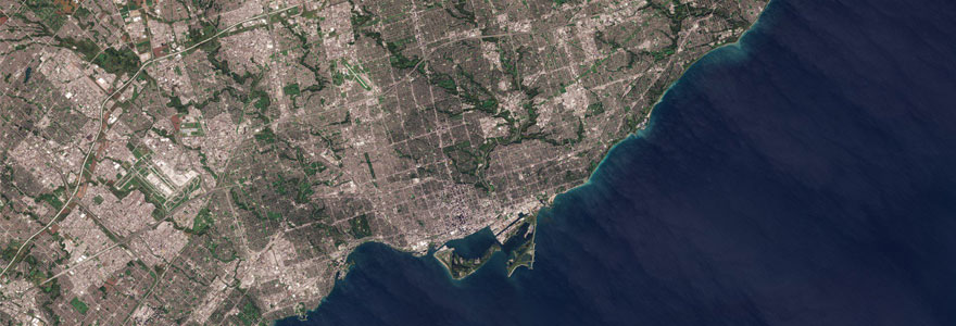
A satellite image of a portion of the Greater Toronto Area centred on Downtown Toronto and the Toronto Islands. (Wikimedia Commons)
Story by Justin Zadorsky
When professor Diana Mok was completing her PhD, she had a chance encounter with a roommate that has since inspired novel research into housing more than 20 years later.
Mok, a professor in the DAN Department of Management & Organizational Studies who studies urban real estate economics, was looking to answer how price volatility in a city’s housing market might influence how compact that city is. To answer this question, she needed to find a way to accurately measure urban sprawl.
This led to the idea of remote sensing, the ability to study and measure an area using technology such as satellite imagery.
“The first time I was introduced to the discipline of remote sensing was when I witnessed my roommate using it to detect changes in migratory patterns of wild geese. I remember at that time I had a passing thought: what about habitats for humans?” said Mok.
The conventional method for measuring urban sprawl uses existing data on populations and boundaries (from Statistics Canada) to determine population density at the fringe of a city, but according to Mok this method can be inaccurate.
If a fixed boundary area is large but where people actually live is clustered (due to large areas of undeveloped land), the population density could be calculated as low despite the high degree of physical clustering.
In this way, the calculated density is an inaccurate depiction of the physical reality.
In 2022, Mok teamed up with geography & environment professor Jinfei Wang and then-student Xiaoxuan Sun, who both specialize in remote sensing. Together, they launched a truly interdisciplinary approach to real estate research with the results published in January 2023.
“The use of satellite imagery and big data, and advancement in technology, are like new treasures that have allowed us to find, improve and implement more creative solutions for answering research questions,” said Mok.
Over the course of two studies, Sun, under the supervision of Mok and Wang, worked to blend the use of satellite imagery with real estate analysis.
“This multidisciplinary research was a challenge for me, especially without a background in economics, but it was also an opportunity. I am grateful for this chance to apply remote sensing technology to the real estate industry and explore some practical situations and issues,” said Sun.
Focusing on 11 cities in Canada, the team used remote sensing to look at on-ground truth versus data estimations of exactly where urban land was being developed outside of cities.
The team found greater price volatility implies a potentially larger gain in the future for developers, which means there is an incentive to wait and hold back on developments. By examining satellite images, they found cities with higher price volatility are more compact than cities with more stable housing markets.
The implication of their findings is that the supply of housing could become less responsive to market factors, and even a slight change in demand could create a larger price swing which then adds to the volatile housing market, leading to less builds.
Each pixel of interpreted satellite images showed the team the type of land use or cover in a 10-metre by 10-metre grid. One challenge was the sheer amount of data, Toronto alone had roughly seven-billion pixels from satellite images in 2016. Despite the vast volume of images, the team was able to draw their conclusions about the concentration of urban land use.
Mok contends real estate can only be better understood by putting it in geographic context and researchers need to look at real estate and cities more comprehensively in terms of their dynamics.
“Research is about improvements. How can we improve the way we understand or explain a problem or phenomenon? In our case, I cannot imagine how the project could have been completed without remote sensing,” said Mok.
Moving forward, Mok says they now face a new technological challenge. This first project looked at urban land outside of cities, but what about land within cities? She says the challenge is satellite images do not allow for detecting over-time changes in building height.
“We need to go beyond 2D and use aerial photographs to detect height changes in 3D. Unfortunately, those images can be costly to acquire,” said Mok.
However, Mok said she feels “wealthy, in a data sense” because the City of Toronto has donated aerial photographs of the entire city in order for changes in urban development to be studied. This allows for the interdisciplinary work to continue and reshape our understanding of real estate geography.